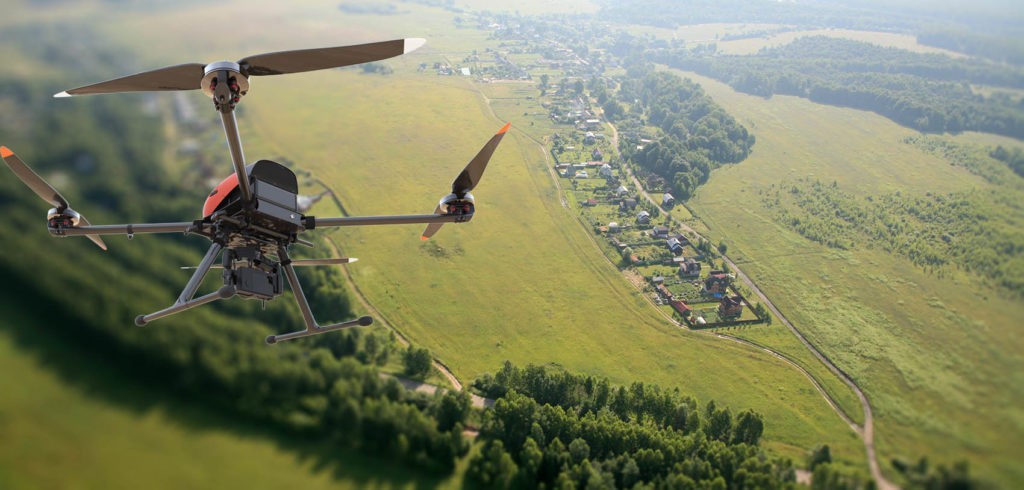
The modern quadrocopter has long outgrown its gaming value, becoming an indispensable assistant for the military, videographers, builders and surveyors. In the latter role, it has been used relatively recently, but has already become an indispensable tool for geodetic aerial photography. The editorial staff of the site "bestx.htgetrid.com/en/" offers you an overview of the best geodetic quadcopters for 2020.
Content
- 1 When is aerial photography used?
- 2 Rating of quality geodetic quadcopters (drones) for 2020
- 3 Conclusion
When is aerial photography used?
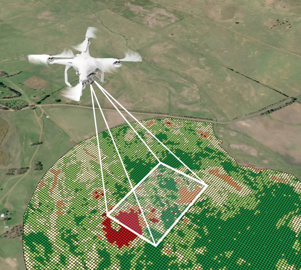
 Not so long ago, surveying took many hours, if not days. But with the advent of unmanned aerial vehicles (UAVs), everything has changed, and now digital survey of the area takes a maximum of a couple of hours, and you can order such a service online on any specialized website. First of all, shooting from a height requires such types of work as:
- Three-dimensional modeling of terrain - when creating a visual model of a district, quarter or a separate street, in construction, when developing a computer game;
- Cartography - creation, updating of existing geographical maps, for military or civilian purposes;
- When monitoring urban planning activities;
- Control and accounting of agricultural land, forestry;
- In order to avoid floods, inundations, photographing of rivers, reservoirs is carried out;
- Cadastral aerial photography, for example, in order to determine the boundaries of the site, mark it for construction.
Moreover, in some cases, topography can be carried out by a simple drone, a more serious type of work requires the use of not just professional equipment, but a whole complex of complex equipment. However, you can draw up something as simple as a plan for your vacation home. To do this, a civilian drone should have only the following extremely important parameters:
- A high-resolution camera so that the picture is of high quality, without moiré, and does not contain errors. When choosing an amateur-class quadrocopter, first of all, they pay attention to the sensitivity of the sensor;
- Engine power - it determines the maximum height to which the drone can rise, how steadily it will take photos, video filming in gusts of wind. Unfortunately, inexpensive popular models do not have such data;
- Battery volume - the autonomous flight time directly depends on the battery, and the more powerful the larger engine it should be;
- Additional modules - there are systems that allow an ordinary quadrocopter to acquire characteristics akin to a specialized model. First of all, devices with an RTK module meet this requirement. This module allows you to fly with an accuracy of a few centimeters (cm).
How high-altitude survey is done
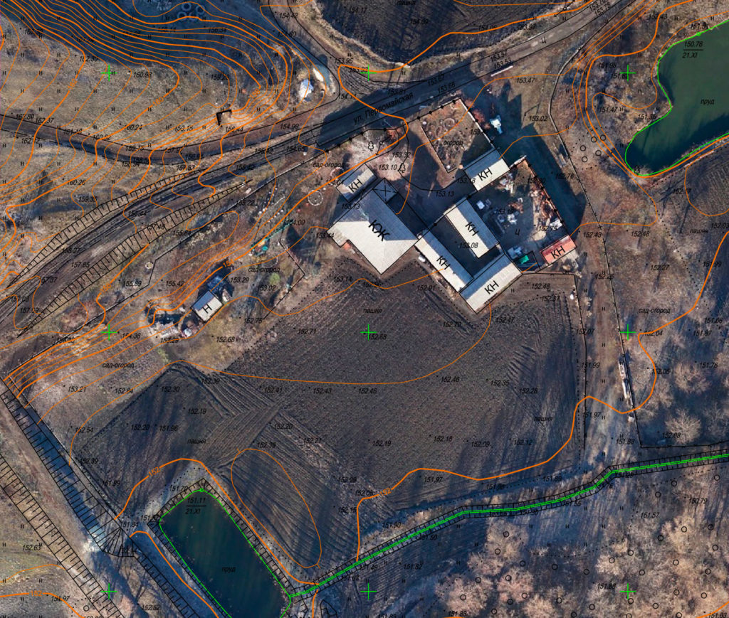
Before launching a survey drone, you should mark the area by determining the coordinates. For this, reference points are placed, or as they are also called, the signs for determining the coordinates. They can also be already created objects on the landscape, the main thing is that they are bright in color and clearly visible.When creating signs for determining coordinates, they are created independently around the survey area and inside it. You can use the curb, road markings, on which crosses are drawn or other similar signs.
After shooting, a specialized computer program will create a kind of skeleton based on them. The program "puts on" the resulting photographs on it, adjusting them to the desired scale, giving them the desired position. The overall accuracy when creating the map depends on how correctly the control points were placed, whether they hit the center of the frame. To avoid all these difficulties, it is best to turn to professionals, since there are many such organizations now.
In addition, it is worth remembering that in Russia there is a law restricting the use of quadrocopters, whose mass is more than 250 grams. And the legislation of some countries simply prohibits their use. Therefore, professional geodetic, cartographic companies are a guarantee of absence and problems with legislation.
Where is the best place to buy
A separate issue is the place of purchase of gadgets, because in the online store of Chinese products, sometimes of dubious quality, there are countless numbers, and only experts know how to recognize a fake. In addition, not all online stores support the manufacturer's warranty period. Thus, expensive, profile systems are best bought through a company store, where you do not have to check the original in your hands or a fake.
What to look for when buying a drone? First of all, you should remember about the adopted UAV labeling, which is usually affixed to the packaging;
- RTF is a fully-equipped aircraft, completely ready for flight;
- BNF - the device does not have a control panel, since experts prefer to customize it, the gadget individually for themselves, creating certain presets;
- ARF - the model is disassembled, not ready for flight. Thus, the model equipment can be replaced with a custom one, for example, the RTK module can be installed at the pre-flight readiness stage;
- PNP - the box contains only an aircraft without any equipment, so you will have to buy a charger, remote control yourself.
Rating of quality geodetic quadcopters (drones) for 2020
Budget, up to 50,000 rubles, models
DJI Phantom 2
The DJI Phantom series is known to everyone who has ever encountered "drones". The initial link is represented by the DJI Phantom 2, this is an advanced entry-level quadrocopter that perfectly copes with all tasks due to the “brain” of the device, its microchip. It is a high-performance aircraft that perfectly stabilizes the flight of the aircraft, allowing for a wide upgrade without additional investment. It is possible to install Bluetooth modules Datalink, Ground Station, with the help of which the device can be controlled via an iOS carrier, setting it an exact route to key points, setting the exact location, altitude, flight duration.
Advantages:
- Wide opportunities for modernization;
- Control through an iPhone or iPad is provided;
- Battery charge efficiency indicator;
- Fast battery replacement;
- The ability to mount a custom camera;
- Acceptable price for this level;
- Wear-resistant, shock-resistant material of the body, engine blades;
- Powerful controller.
Disadvantages:
- There is no camera.
Holy Stone HS100
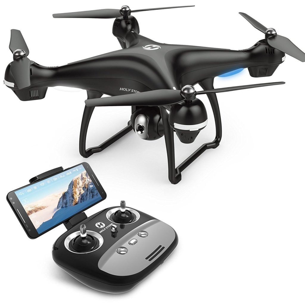
An entry-level model that customers believe is a direct competitor to the DJI Phantom. The device is equipped with a high resolution 1080P camera with a viewing angle of 120 degrees. With its help, you can view the environment through a virtual helmet, the main thing is that it supports the function of signal transmission via Wi-Fi. This allows you to accurately select the appropriate view, angle for landscape photography. Holy Stone HS100 has a unique tracking system for a selected point or object, set by the model owner. That is, having indicated a certain fixed, movable point, the UAV will hover over it or will follow this object.Moreover, you shouldn't worry about the loss of the HS100, in case of Holy Stone the HS100 will automatically return to its original takeoff location.
Advantages:
- Affordable;
- The best functionality in the class of budget UAVs;
- Maintaining altitude without determining orientation;
- Support for helmets, virtual reality glasses.
Disadvantages:
- Six hours of battery charging;
- Unstable body material.
Models from 50,000 to 100,000 rubles
DJI Phantom 3 Advanced
![]()
A UAV that perfectly combines professional functionality with the ease of control that is inherent in amateur gadgets. If you are wondering which drone is better to buy to get started in the field of cartography and geodesy, pay your attention to the DJI Phantom 3 Advanced. Comparison with other models, including the DJI Phantom 3 Standard, shows the undeniable advantage of Advanced as it works over a radio channel. That is, the models mentioned above were controlled via wi-fi, which limited the flight range. In the DJI Phantom 3 Advanced, it is up to 3500 m.The quadcopter is easy to carry from place to place, since the kit (remote control, battery, the device itself) is compactly placed in a backpack. Therefore, the model has earned laudatory recommendations from those who have to work on the road, cadastral services, geologists.
Advantages:
- Autopilot (take off, landing);
- Smart flight control with the function of warning about restricted areas;
- The minimum flight range is 2000 meters;
- Well equipped with sensors (ultrasonic, magnetometer, accelerometer, barometer);
- Simple controls;
- The presence of a slot for a memory card;
- High, up to 16 m / s flight speed;
- Light weight.
Disadvantages:
- The camera quality is poor.
DJI Mavic Pro
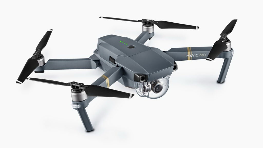
Powerful, multifunctional model, compact size. First of all, the range of video transmission, photo recording, over 6 kilometers, is striking for such a price category. And the quality of video transmitted at such a distance does not get worse, since the DJI Mavic Pro has its own noise reduction algorithm. This is simply an invaluable quality, all the more so when using the device in urban conditions, with difficult terrain. A distinctive feature of the DJI Mavic Pro is the satellite navigation function, when the device loses communication with satellites, the visual orientation function turns on. It allows you to work without satellite navigation, as well as independently determine objects, obstacles that need to be avoided in order to avoid collisions. For this and many other reasons, the DJI Mavic Pro has earned the most positive reviews from experts. And of course, the description of the model would not be complete if the possibility of uploading streaming video to popular social networks was not mentioned.
Advantages:
- Compact size;
- Proprietary interference suppression algorithm;
- Recognition of gestures;
- Ability to set the desired subject to be shot, even if it is moving;
- High, up to 18 m / s speed and flight range;
- Support for Adobe DNG RAW format;
- First-person camera control;
- Shooting video format 4K.
Disadvantages:
- Long, up to two hours, video processing time;
- Relatively poor image quality in low light;
- Intermittent problems with the memory card.
Models in the price range 100,000 - 500,000 rubles
DJI Mavic 2 Pro
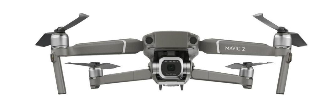
An improved version of the above model, which takes into account the disadvantages of the previous model with the improvement of the existing characteristics. For example, there is also tracking of a user-specified moving object, but now it can have a speed of up to 70 km / h. At the same time, even if the object being shot suddenly disappears behind an obstacle, the DJI Mavic 2 Pro's intelligent system will calculate the algorithm for its further pursuit. And thanks to the advanced Hasselblad camera with improved sensor, HDR shooting is possible even in low light conditions. If your selection criteria are versatility with a compact UAV, then be sure to pay attention to the DJI Mavic 2 Pro.
Advantages:
- Support for SD cards up to 128 gigabytes;
- Flight time up to half an hour;
- Excellent quality of the transmitted video at a distance of up to 8 km;
- Automatic stabilization of the captured image during flight;
- Compact size;
- High strength material of manufacture;
- Easy setup, management;
- Speed up to 70 km per hour.
Disadvantages:
- Not noticed.
Yuneec H520
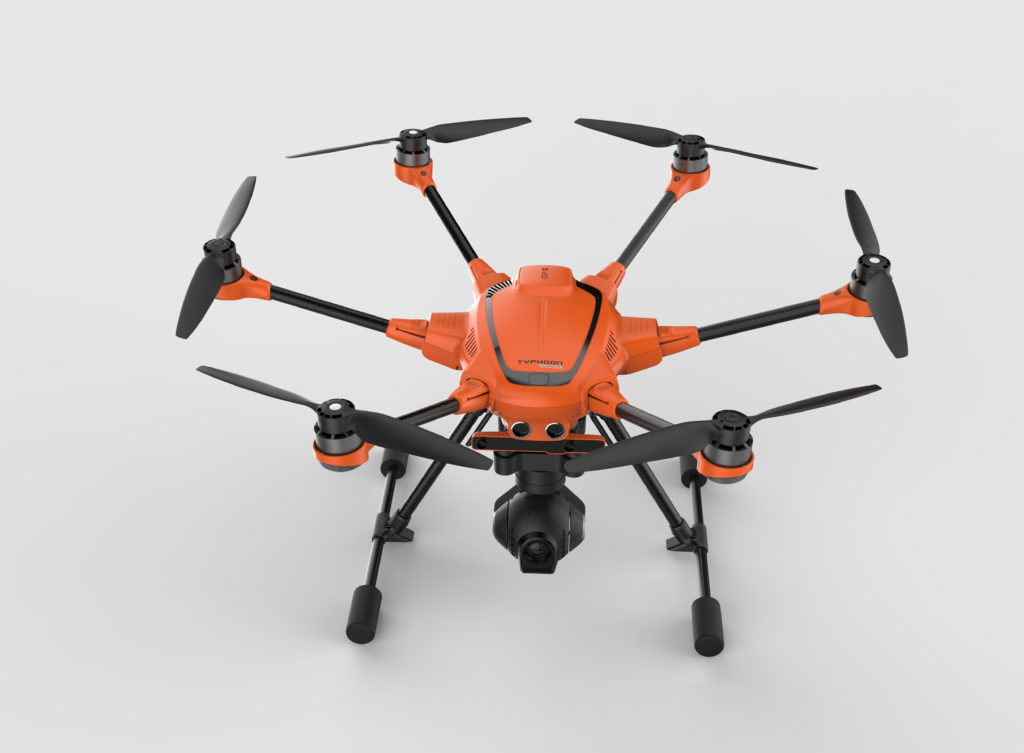
In essence, the Yuneec H520 is a hexacopter, that is, an apparatus with six engines. The device is brightly colored, which allows you not to lose sight of it, has wide, almost noiseless blades and high lifting capacity. Therefore, it can be attached to additional equipment, in addition to the camera, which makes the model in demand on the market of commercial devices. The flight path can be programmed in advance by setting key flight points. A distinctive feature of the hexacopter is its multifunctional remote control, the "heart" of which is a quad-core Intel processor. Operation is simplified thanks to the high performance of the processor and the presence of a high-contrast 7 "screen. The highlight of Yuneec H520 is a special Intel RealSense system, it allows avoiding obstacles based on the built 3D model, then memorizing them, which makes the hexacopter's flight easy and safe.
Advantages:
- The ability to install specialized cameras;
- Sixteen channel control panel;
- Five intelligent flight modes;
- Dual communication channel.
Disadvantages:
- Not noticed.
Models from 500,000 rubles
Geoscan 401
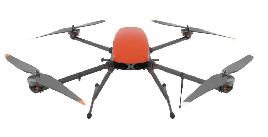
An industrial model of Russian production, which has proven itself in extreme climatic conditions. The model is easily upgraded to the needs of the user and is presented in three versions. With Sony DSC-RX1, Sony A5000 or multispectral camera based on the latest camera. It is also allowed to hang the thermal imager. And since the device is expensive, the manufacturer worried about the safety of the flight, providing for the option of an emergency landing.
Advantages:
- Resistant to gusts of wind;
- Several upgrade options;
- 3D modeling;
- A wide range of supplied software;
- Automatic piloting along a given route.
Disadvantages:
- Large dimensions.
Phantom 4 RTK + D-RTK 2 Mobile Station Combo
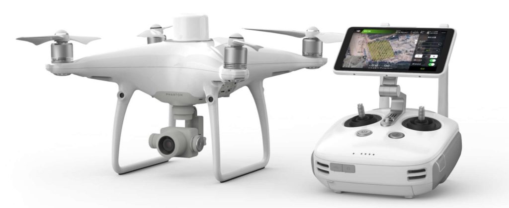
And the professional model Phantom 4 RTK + D-RTK 2 Mobile Station Combo with the mobile station D-RTK 2 completes our rating of quality drones. The latter gives positioning accuracy up to one centimeter. Accordingly, the user will spend less time on the subsequent processing of the card. The accuracy of shooting is also ensured by the intelligent function TimeSync, which optimizes the operation of the controller of the gadget, the camera and the D-RTK 2 module. Moreover, TimeSync uses the metadata of each frame, changing information as it moves. Considering the advantages of the Phantom 4 RTK + D-RTK 2, the question of how much is fading into the background.
Advantages:
- Support for USB 4G modems;
- Positioning accuracy up to one centimeter;
- Flight altitude up to 6 kilometers;
- Control up to 5 drones from one remote control;
- Algorithm that takes into account the curvature of the lenses when accounting for metadata.
Disadvantages:
- Price.
Which company is better to buy a quadrocopter?
Naturally, good equipment of a particularly specialized level is expensive. The average price of a gadget capable of "stretching" geodetic and cartographic tasks is about 80,000 rubles. A professional grade geodetic drone costs more than 1,500,000 rubles. Therefore, the quality of the purchased equipment is given special attention. Its pledge is, first of all, branded products. In addition to manufacturers whose equipment is reflected in the rating, you can pay attention to other brands. Other leading manufacturers of these products are companies such as:
- Eachine is a Chinese brand with a twenty-year history of creating innovative technology that has earned the best reviews from users. The main difference between Eachine technique is loyal prices with high functionality.
- Parrot is a European manufacturer of various, including household electronic appliances. Parrot products have always attracted attention due to advanced technologies, wide price range, and interesting design performance.
- Syma is another manufacturer from China, whose main specialization is design, development, creation of multipurpose helicopters. Thus, the transition to a smaller, rotorcraft was a completely predictable process. The Syma lineup is distinguished from competitors primarily by its compactness of production, high-resolution photosensors, simple operation that does not require specific skills.
- Blade is a well-known American manufacturer of UAV features of which - high speed, powerful engines, allowing you to hold position even in strong winds.
- Walkera is a renowned Hong Kong based company founded 26 years ago with branches all over the world. Therefore, the technical support of its equipment, the availability of spare parts are an undoubted advantage of this company. The popularity of Walkera models is due to the great functionality of unmanned aerial vehicles. The range of the company's UAVs varies from high-speed, amateur systems to specialized ones, including geodetic devices.
Conclusion
When writing the article, the author first of all took into account the already recommended, proven models. If you know a more functional device, if you have experience in buying, controlling a drone, leave your comment under the article or give advice on how to choose where to buy a good quality device. We will also be glad to clarify what other useful functions of the quadcopter can be mentioned.


 for 2020")


